New Technological Frontiers for Mediterranean Navigation |
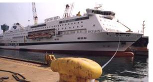
On 20th November 2006 the Gnv cruise ferry Excellent, owned by the Grimaldi group, set sail from Porto Torres, Genoa carrying onboard new instruments that are bound to change future navigation in the Mediterranean. The instruments were supplied by WERMED (Weatherrouting dans le Méditerranée). This is a project partly financed by the European Regional Development Fund (ERDF) through the Interreg IIIB MEDOCC Community Initiative, which forms part of the Structural Funds Programme for Malta (2004-2006). Weatherrouting is a means of optimizing shipping routes on the basis of meteo-marine conditions. Unfavourable conditions at sea often cause considerable delays in marine transportation and higher operational costs and fuel consumption. The forecasting of wind, sea state and currents permits an anticipated assessment for optimization of routes to enable the most convenient navigation at lowest costs, minimal risk to the environment and highest safety for crew, passengers and cargo. |
|
The WERMED project is led by the Italian agency CINFAI (Consorzio Interuniversitario per la Fisica delle Atmosfere ed Idrosfere), and involves partners from some of the main MEDOCC countries with clear maritime interests, namely Italy, Greece and Malta. The Maltese partner to the project is IOI-Malta Operational Centre of the University of Malta, and the implementation of the local tasks are coordinated by Dr. Aldo Drago, Director of IOI-MOC. IOI-MOC is working on the implementation of the system in the Central Mediterranean area, with special emphasis on the area around the Maltese Islands.
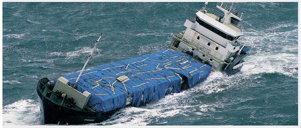
The first studies on the related software were carried out last May and operations onboard Excellent commenced last October, following an agreement between Arpal and the Grimaldi Group. The first two voyages embarked upon by the cruise ferry following installation of the software proved to be successful; the forecasting data supplied was reliable, and the meteo forecast helped the vessel avoid a squall with 90km/hour winds and waves surpassing 3 metres in height.
The successful turnout has laid the way for the project’s future and new shipping lines are in the process of being added, starting with the Genoa-Tunisi-Malta-Genoa line. Other shipping lines currently in operation include Limassol-Cagliari and Peiraieus-Genoa, both passing by the Maltese Islands. Presently, there are over 15 vessels on the project’s database, with more waiting to be added.
|
A web service is also due to be launched whereby captains of vessels can find the models on the database which have very similar characteristics to their own vessels and ask to receive simulation data based on these, including regular 72-hour and 48-hour meteo-marine forecasts. Captains fill in a form on an hourly basis giving realtime data (velocity, consumption, geographic coordinates) on their vessel to help improve the accuracy of the forecast. The only current drawback of the system is the absence of data from within ports and for the last two miles of navigation, where it is far more difficult to maneuver a vessel, but work to tackle this is in progress. |
The Gnv cruise ferry Excellent moored at the port of Genoa. |
Local work carried out by the IOI-MOC includes a Wind and Wave Climatology Study covering the Maltese coastal area and the Central Mediterranean. These climatologies give statistical information in the form of maps on wind incidence and strength and significant wave height and wave direction on a grid at 1/8° degree resolution in space.
Another important deliverable of the WERMED project is the atmospheric and forecasting system. The MARIA/Eta Atmospheric forecasting system was completed and the online publishing of daily forecasts at the regional and sub-regional scale on the Malta Page for WERMED can be viewed on (http://www.capemalta.net/maria/pages/atmoforecast.html)
The project will be also assessing the potential risks of Mediterranean main shipping routes, focusing on economical costs of running ships during different types of weather and evaluating the socioeconomic impacts of ship-routing.
For further information about WERMED visit www.wermed.net
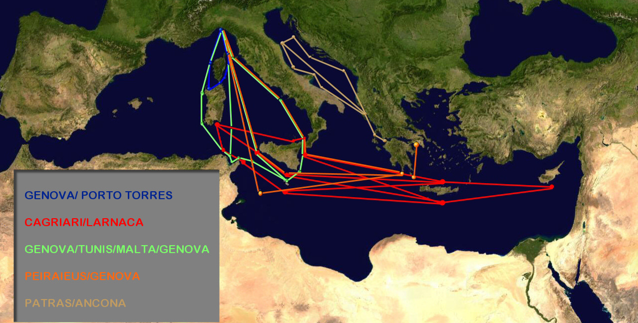 |
Main shipping routes covered by the WERMED project. |