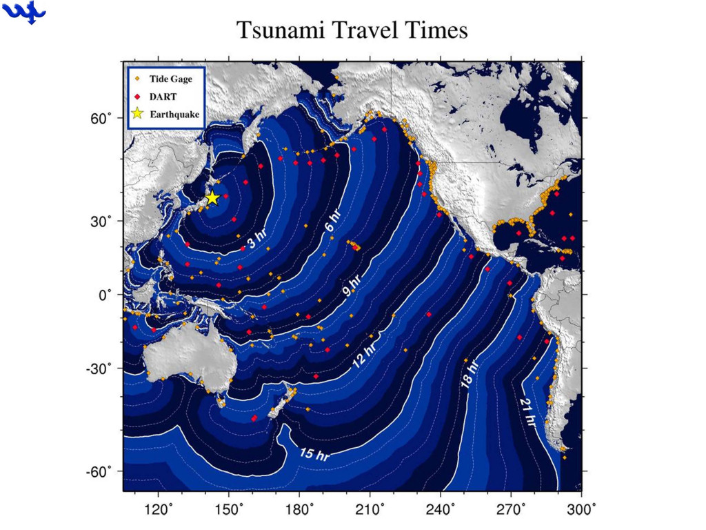
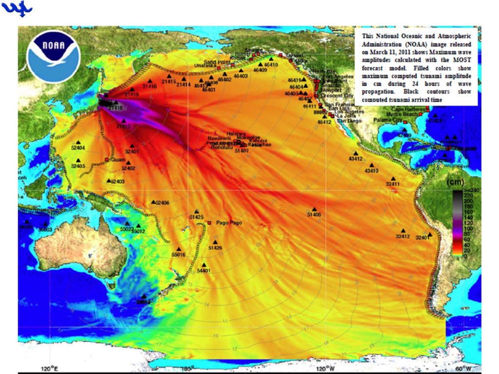
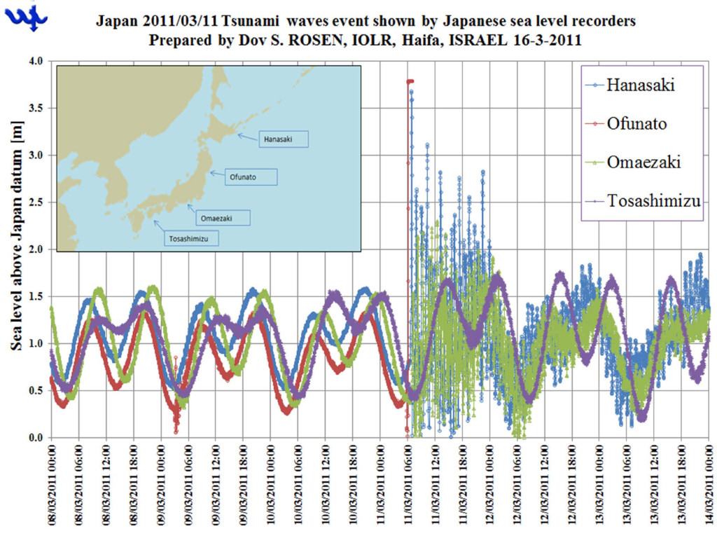
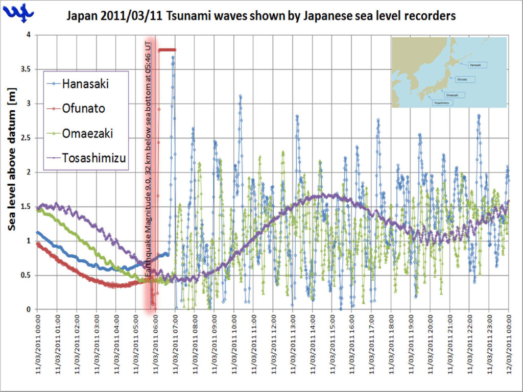
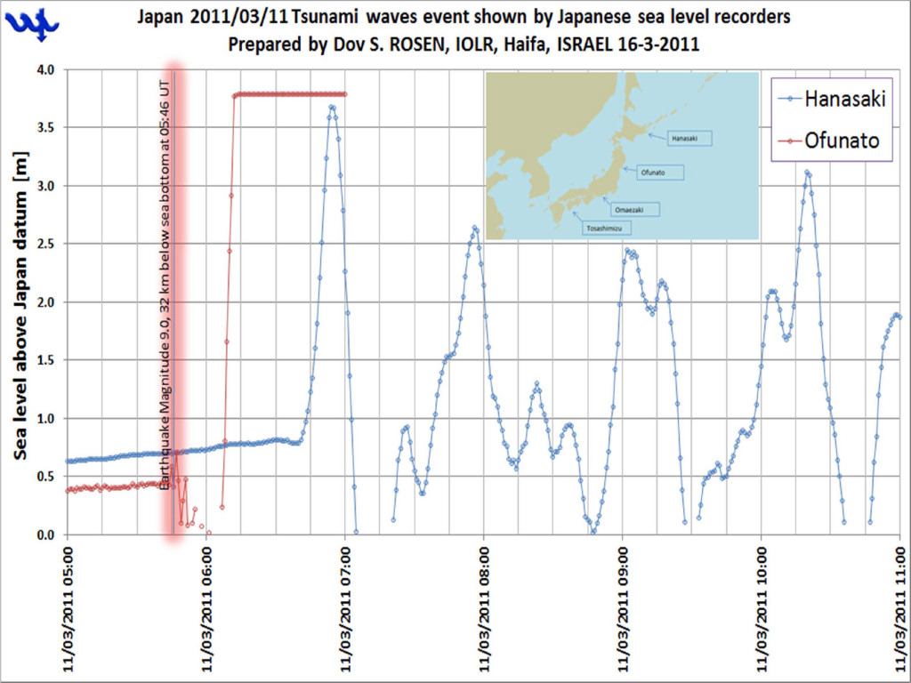
A FEW SEA LEVEL RECORDS REPRESENTING THE JAPAN 11 MARCH 2011 TSUNAMI WAVES DUE TO THE 9 M EARTHQUAKE, AT 32 KM BELOW SEA BOTTOM, ON ~ 700M DEPTH CONTOUR AT 05:46:23 HOURS UNIVERSAL TIME

prepared by

Dov S. ROSEN

Israel Oceanographic & Limnological Research (IOLR) Tel Shikmona, Haifa, Israel, email: rosen@ocean.org.il MedGLOSS Programme Coordinator (http://medgloss.ocean.org.il)

Co-Chair, ICG/NEAMTWS WG3 on Sea Level Data Collection and Exchange

(http://www.ioc-tsunami.org/index.php?option=com_content&view=article&id=10&Itemid=14&lang=en)

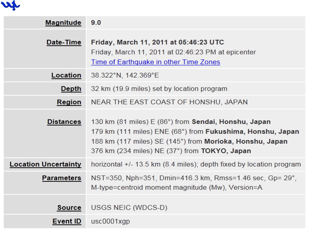
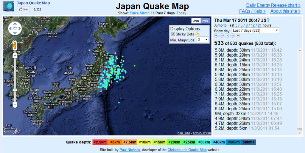
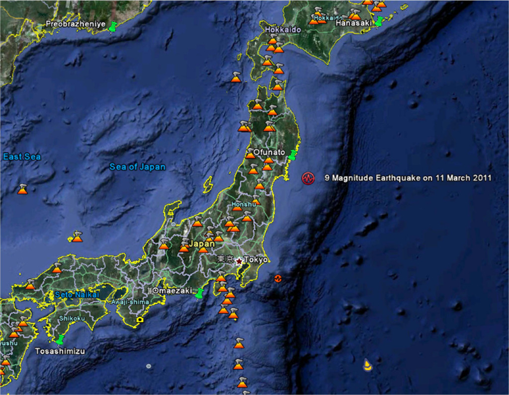
Location of the earthquakes on 11/3/2011 off Sendai City, including the mega earthquake of magnitude 9 at 32km below sea bottom (at about 500m water depth)

MAP SOURCE: http://www.japanquakemap.com/week

Address provided by Prof. Frederic Briand, CIESM Director General

Location of the 9M earthquake off Honshu, at about 700m water depth, of sea level stations (green pins) and of existing vulcanoes (orange triangles)

A FEW COMMENTS ON THE SHOWN DATA


1. DATA TAKEN FROM 4 JAPAN’S 1 MINUTE SEA LEVEL STATIONS

2. THE TSUNAMI WAVE AT OFUNATO SEEMS THAT STARTED BY LOWERING OF THE WATER LEVEL, WHEREAS THE TSUNAMI WAVE AT HANASAKI STARTED BY A WATER LEVEL RISE

3. THERE WERE A NUMBER OF TSUNAMI WAVES, WITH AN APPROXIMATE PERIOD OF 60 MINUTES

4. THE TSUNAMI WAVE AT OFUNATO, SEEMS THAT REACHED THE STATION LOCATED CLOSE TO SHORE ABOUT 20 MINUTES AFTER THE QUAKE EVENT