TSUNAMI HITS STROMBOLI
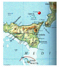 On 30th December 2002 in the Eolian island, Stromboli, the volcanic activity has led to a giant
sea wave approximately 20m high. The wave, technically known as tsunami, was
generated by landslides of lava layers in the eastern area known as ‘Sciara del Fuoco’, on impact with the sea. Most probably
the lava that erupted two days before, increased the load on the steep slopes
of the volcano, making the whole area unstable and determining the collapse in
the sea. Experts from the Istituto Nazionale di Geofisica
e Vulcanologia (INGV) in Catania said that there is no evidence of summit
explosions, and explained that the collapse was determined
by the gravitational instability of the area. This hypothesis is supported by two non-volcanic seismic events at 13:15 and 13:22 local time, recorded by the INGV’s
instruments. Measurements done by this institute have estimated that the volume
of the first landslide was approximately 600 cubic meters, whilst the second
one, which actually generated the wave, was calculated
to have a volume of 4 million cubic meters.
On 30th December 2002 in the Eolian island, Stromboli, the volcanic activity has led to a giant
sea wave approximately 20m high. The wave, technically known as tsunami, was
generated by landslides of lava layers in the eastern area known as ‘Sciara del Fuoco’, on impact with the sea. Most probably
the lava that erupted two days before, increased the load on the steep slopes
of the volcano, making the whole area unstable and determining the collapse in
the sea. Experts from the Istituto Nazionale di Geofisica
e Vulcanologia (INGV) in Catania said that there is no evidence of summit
explosions, and explained that the collapse was determined
by the gravitational instability of the area. This hypothesis is supported by two non-volcanic seismic events at 13:15 and 13:22 local time, recorded by the INGV’s
instruments. Measurements done by this institute have estimated that the volume
of the first landslide was approximately 600 cubic meters, whilst the second
one, which actually generated the wave, was calculated
to have a volume of 4 million cubic meters.
Tsunamis or seismic sea waves are
commonly produced by movements of the earth’s crust, which cause a
sudden rise or fall in the overlying sea surface. When there is a rise, gravity
causes the suddenly elevated water to return to the equilibrium surface level.
On the other hand if there is a depression, gravity
forces the water column to flow into it. In both cases, waves with extremely
long wavelengths (100 or 200 km) are generated and are
propagated from the point of seismic disturbance at a speed determined by the
ocean’s depth. The height of the tsunami is distributed
along its wavelength. When the path of the wave is blocked
by a coast or island, it slows, its wavelength decreases and its energy is
compressed into a smaller water volume as the depth rapidly decreases. The
confinement of energy causes the wave height to build rapidly, and the loss of
energy is equally rapid when the wave breaks. This leads to an energetic
flooding of the coastal area.
The tsunami in Stromboli has caused major damages in the strombolian
inhabited area called Ginostra, and in other
areas of the island. It has swept away boats, damaged
houses situated along the coast and injured six people. Other minor effects of
the giant wave were recorded in the confining Eolian islands. Also a
tanker was seriously hit by the wave, causing oil spills. According to the
experts from the Civil Protection and INGV this
phenomenon won’t be repeating itself shortly.
In the last months several
seismic and eruptive activities have been recorded in the Sicily area: the impetuous eruptions of Etna,
the earthquakes near Palermo and Ustica, the
sea boiling phenomenon near the island of Panarea, and the emergence of the submerged
island known as Ferdinandea. Enzo
Boschi, director of INGV, has explained to the press
that all these events are determined by not well understood
geodynamic movements of the African and Eurasian Tectonic Plates. Experts
however say that the situation in under control and that no serious events are
predicted.
In Malta no special sea level anomalous signal has
been observed on the day of the Stromboli event. Sea level observations in Malta are conducted in
Mellieha Bay by means of a digital tide gauge operated
by the Physical Oceanography Unit of the IOI-Malta Operational Centre within
the University of Malta. In Malta the only known recorded tsunami is that
associated to the Messina Straits earthquake on 28th
December 1908.
The earthquake was accompanied by a disastrous tsunami which
wiped out all the eastern coast of Sicily, and reached Malta some 55 minutes afterwards. The local
newspapers reported exceptional high sea levels in Msida
Creek and Marsaxlokk Bay. In Msida,
seaside resorts and storage houses were inundated with
damage to property and merchandise. In Marsaxlokk
the impact must have been stronger and fishing boats were crashed against the
quay. The tsunami was accompanied by a strong seiche in the Grand harbour where
the sea level gauge recorded sea level fluctuations with a maximum
crest-to-trough excursion of 2 feet 11.8 inches (= 0.91m). The seiche persisted
until late evening. These sea level registrations constitute the only useful
records for this tsunami.
For further information you can visit the following links